Polygons Layer in .NET MAUI Maps
18 Nov 201819 minutes to read
Prerequisite: Ensure that the required NuGet package is installed, the necessary namespaces are imported, and the Maps control is properly configured in your application. For detailed setup and configuration instructions, refer to the Getting Started guide.
The polygon layer is a sublayer that renders a group of MapPolygon on a MapPolygonLayer, which can be added as a sublayer of MapShapeLayer. This section explains how to add and customize polygons.
Adding polygons
The Polygons is a collection of MapPolygon. Each MapPolygon is drawn from multiple coordinates specified by the Points property. At least three points are required to render a polygon. In C#, set the Points to an ObservableCollection<MapLatLng>. In XAML, add MapLatLng items directly as child elements of the Points property. When the MapPolygon.Fill, MapPolygon.Stroke, and MapPolygon.StrokeThickness properties are not set, the default Fill/Stroke colors and a stroke thickness of 2 (measured in device-independent units) are applied.
<map:SfMaps>
    <map:SfMaps.Layer>
        <map:MapShapeLayer ShapesSource="https://cdn.syncfusion.com/maps/map-data/world-map.json"
                           ShapeStroke="DarkGray">
            <map:MapShapeLayer.Sublayers>
                <map:MapPolygonLayer>
                    <map:MapPolygonLayer.Polygons>
                        <map:MapPolygon>
                            <map:MapPolygon.Points>
                                <map:MapLatLng Latitude="55.7558"
                                               Longitude="37.6173" />
                                <map:MapLatLng Latitude="53.7596"
                                               Longitude="87.1216" />
                                <map:MapLatLng Latitude="61.5240"
                                               Longitude="105.3188" />
                            </map:MapPolygon.Points>
                        </map:MapPolygon>
                        <map:MapPolygon>
                            <map:MapPolygon.Points>
                                <map:MapLatLng Latitude="64.2823"
                                               Longitude="-135.0000" />
                                <map:MapLatLng Latitude="51.2538"
                                               Longitude="-85.3232" />
                                <map:MapLatLng Latitude="48.4284"
                                               Longitude="-123.3656" />
                            </map:MapPolygon.Points>
                        </map:MapPolygon>
                    </map:MapPolygonLayer.Polygons>
                </map:MapPolygonLayer>
            </map:MapShapeLayer.Sublayers>
        </map:MapShapeLayer>
    </map:SfMaps.Layer>
</map:SfMaps>
var maps = new SfMaps();
var layer = new MapShapeLayer();
layer.ShapesSource = MapSource.FromUri(new Uri("https://cdn.syncfusion.com/maps/map-data/world-map.json"));
layer.ShapeStroke = Brush.DarkGray;
var mapPolygonLayer = new MapPolygonLayer();
var polygon1 = new MapPolygon();
polygon1.Points = new ObservableCollection<MapLatLng>()
{
new MapLatLng(55.7558, 37.6173),
new MapLatLng(53.7596, 87.1216),
new MapLatLng(61.5240, 105.3188)
};
var polygon2 = new MapPolygon();
polygon2.Points = new ObservableCollection<MapLatLng>()
{
new MapLatLng(64.2823, -135.0000),
new MapLatLng(51.2538, -85.3232),
new MapLatLng(48.4284, -123.3656)
};
mapPolygonLayer.Polygons.Add(polygon1);
mapPolygonLayer.Polygons.Add(polygon2);
layer.Sublayers.Add(mapPolygonLayer);
maps.Layer = layer;
this.Content = maps;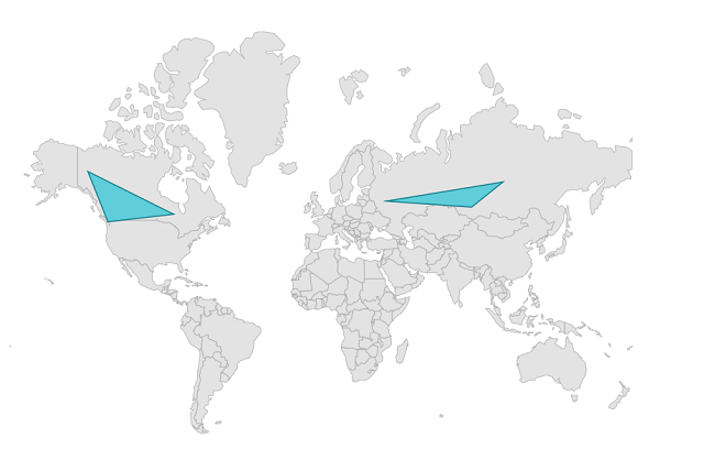
Fill color
You can apply a color to each MapPolygon in the Polygons collection using the individual MapPolygon.Fill property. When the MapPolygon.Fill property is not set, the default fill color is applied.
<map:SfMaps>
    <map:SfMaps.Layer>
        <map:MapShapeLayer ShapesSource="https://cdn.syncfusion.com/maps/map-data/world-map.json"
                           ShapeStroke="DarkGray">
            <map:MapShapeLayer.Sublayers>
                <map:MapPolygonLayer>
                    <map:MapPolygonLayer.Polygons>
                        <map:MapPolygon Fill="#6defae">
                            <map:MapPolygon.Points>
                                <map:MapLatLng Latitude="55.7558"
                                               Longitude="37.6173" />
                                <map:MapLatLng Latitude="53.7596"
                                               Longitude="87.1216" />
                                <map:MapLatLng Latitude="61.5240"
                                               Longitude="105.3188" />
                            </map:MapPolygon.Points>
                        </map:MapPolygon>
                        <map:MapPolygon Fill="#ec407f">
                            <map:MapPolygon.Points>
                                <map:MapLatLng Latitude="64.2823"
                                               Longitude="-135.0000" />
                                <map:MapLatLng Latitude="51.2538"
                                               Longitude="-85.3232" />
                                <map:MapLatLng Latitude="48.4284"
                                               Longitude="-123.3656" />
                            </map:MapPolygon.Points>
                        </map:MapPolygon>
                    </map:MapPolygonLayer.Polygons>
                </map:MapPolygonLayer>
            </map:MapShapeLayer.Sublayers>
        </map:MapShapeLayer>
    </map:SfMaps.Layer>
</map:SfMaps>
var maps = new SfMaps();
var layer = new MapShapeLayer();
layer.ShapesSource = MapSource.FromUri(new Uri("https://cdn.syncfusion.com/maps/map-data/world-map.json"));
layer.ShapeStroke = Brush.DarkGray;
var mapPolygonLayer = new MapPolygonLayer();
var polygon1 = new MapPolygon();
polygon1.Points = new ObservableCollection<MapLatLng>()
{
new MapLatLng(55.7558, 37.6173),
new MapLatLng(53.7596, 87.1216),
new MapLatLng(61.5240, 105.3188)
};
polygon1.Fill = Color.FromRgb(109, 239, 174);
var polygon2 = new MapPolygon();
polygon2.Points = new ObservableCollection<MapLatLng>()
{
new MapLatLng(64.2823, -135.0000),
new MapLatLng(51.2538, -85.3232),
new MapLatLng(48.4284, -123.3656)
};
polygon2.Fill = Color.FromRgb(236, 64, 127);
mapPolygonLayer.Polygons.Add(polygon1);
mapPolygonLayer.Polygons.Add(polygon2);
layer.Sublayers.Add(mapPolygonLayer);
maps.Layer = layer;
this.Content = maps;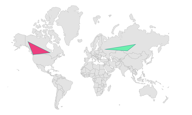
Stroke color
You can apply a stroke color to each MapPolygon in the Polygons collection using the individual MapPolygon.Stroke property. When the MapPolygon.Stroke property is not set, the default stroke color is applied.
Stroke thickness
You can apply stroke thickness to each MapPolygon in the Polygons collection using the individual MapPolygon.StrokeThickness property. The default value of the MapPolygon.StrokeThickness property is 2, measured in device-independent units.
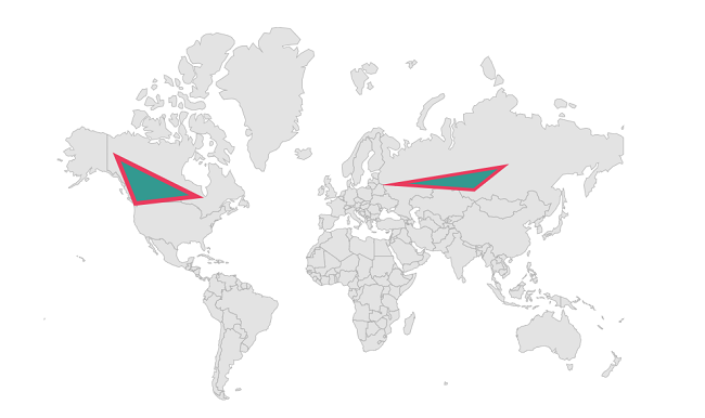
The example below applies both MapPolygon.Stroke and MapPolygon.StrokeThickness using the color #ea3b5e.
<map:SfMaps>
    <map:SfMaps.Layer>
        <map:MapShapeLayer ShapesSource="https://cdn.syncfusion.com/maps/map-data/world-map.json"
                           ShapeStroke="DarkGray">
            <map:MapShapeLayer.Sublayers>
                <map:MapPolygonLayer>
                    <map:MapPolygonLayer.Polygons>
                        <map:MapPolygon Stroke="#ea3b5e"
                                        StrokeThickness="3">
                            <map:MapPolygon.Points>
                                <map:MapLatLng Latitude="55.7558"
                                               Longitude="37.6173" />
                                <map:MapLatLng Latitude="53.7596"
                                               Longitude="87.1216" />
                                <map:MapLatLng Latitude="61.5240"
                                               Longitude="105.3188" />
                            </map:MapPolygon.Points>
                        </map:MapPolygon>
                        <map:MapPolygon Stroke="#ea3b5e"
                                        StrokeThickness="4">
                            <map:MapPolygon.Points>
                                <map:MapLatLng Latitude="64.2823"
                                               Longitude="-135.0000" />
                                <map:MapLatLng Latitude="51.2538"
                                               Longitude="-85.3232" />
                                <map:MapLatLng Latitude="48.4284"
                                               Longitude="-123.3656" />
                            </map:MapPolygon.Points>
                        </map:MapPolygon>
                    </map:MapPolygonLayer.Polygons>
                </map:MapPolygonLayer>
            </map:MapShapeLayer.Sublayers>
        </map:MapShapeLayer>
    </map:SfMaps.Layer>
</map:SfMaps>
var maps = new SfMaps();
var layer = new MapShapeLayer();
layer.ShapesSource = MapSource.FromUri(new Uri("https://cdn.syncfusion.com/maps/map-data/world-map.json"));
layer.ShapeStroke = Brush.DarkGray;
var mapPolygonLayer = new MapPolygonLayer();
var polygon1 = new MapPolygon();
polygon1.Points = new ObservableCollection<MapLatLng>()
{
new MapLatLng(55.7558, 37.6173),
new MapLatLng(53.7596, 87.1216),
new MapLatLng(61.5240, 105.3188)
};
polygon1.Stroke = Color.FromRgb(234, 59, 94);
polygon1.StrokeThickness = 3;
var polygon2 = new MapPolygon();
polygon2.Points = new ObservableCollection<MapLatLng>()
{
new MapLatLng(64.2823, -135.0000),
new MapLatLng(51.2538, -85.3232),
new MapLatLng(48.4284, -123.3656)
};
polygon2.Stroke = Color.FromRgb(234, 59, 94);
polygon2.StrokeThickness = 4;
mapPolygonLayer.Polygons.Add(polygon1);
mapPolygonLayer.Polygons.Add(polygon2);
layer.Sublayers.Add(mapPolygonLayer);
maps.Layer = layer;
this.Content = maps;