User interaction in Windows Forms Map (Maps)
9 Jul 202624 minutes to read
Options such as zooming, selection, and tooltip enable effective interaction on map elements.
Tooltip support
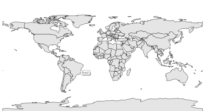
Tooltip is a hanging window that will be shown when the shape is tapped. This is used to show additional information from the object bound with the shape. By default, it takes the property of the bound object, which is referred to by the ShapeValuePath and displays its content when the corresponding shape is tapped.
Tooltip is shown only when the ShowToolTip is set to true in the shape file layer.
Code sample
partial class Form1
{
    private Syncfusion.Windows.Forms.Maps.Maps mapsControl1;

    private void InitializeComponent()
    {
        this.mapsControl1 = new Syncfusion.Windows.Forms.Maps.Maps();
        this.mapsControl1.Name = "mapsControl1";
        this.mapsControl1.Size = new System.Drawing.Size(880, 585);
        this.Controls.Add(this.mapsControl1);
        this.ClientSize = new System.Drawing.Size(880, 585);
        this.Load += new System.EventHandler(this.Form1_Load);
    }
}
Partial Class Form1
Private mapsControl1 As Syncfusion.Windows.Forms.Maps.Maps
Private Sub InitializeComponent()
Me.mapsControl1 = New Syncfusion.Windows.Forms.Maps.Maps()
Me.mapsControl1.Name = "mapsControl1"
Me.mapsControl1.Size = New System.Drawing.Size(880, 585)
Me.Controls.Add(Me.mapsControl1)
Me.ClientSize = New System.Drawing.Size(880, 585)
AddHandler Me.Load, New System.EventHandler(AddressOf Me.Form1_Load)
End Sub
End Classpublic partial class Form1 : Form
{
private void Form1_Load(object sender, EventArgs e)
{
this.mapsControl1.Dock = DockStyle.Fill;
this.mapsControl1.Margin = new Padding(0, 0, 4, 0);
this.mapsControl1.MapBackgroundBrush = new SolidBrush(Color.White);
this.mapsControl1.MapItemsShape = Syncfusion.Windows.Forms.Maps.MapItemShapes.None;
MapViewModel model = new MapViewModel();
ShapeFileLayer shapeLayer = new ShapeFileLayer();
shapeLayer.Uri = "world1.shp";
shapeLayer.ItemSource = model.Countries;
shapeLayer.ShapeIDPath = "NAME";
shapeLayer.ShapeIDTableField = "NAME";
shapeLayer.ShapeSetting.ShapeValuePath = "Population";
shapeLayer.ShapeSetting.ShapeColorValuePath = "Population";
shapeLayer.ShapeSetting.ShapeDisplayValuePath = "NAME";
shapeLayer.ShapeSetting.TextForeground = "Black";
shapeLayer.ShowMapItem = false;
shapeLayer.ShowToolTip = true;
shapeLayer.ShapeSetting.ShapeFill = "#E5E5E5";
shapeLayer.ShapeSetting.ShapeStrokeThickness = 1.5;
shapeLayer.ShapeSetting.ShapeStroke = "Black";
shapeLayer.ShapeSetting.FillSetting.AutoFillColors = false;
this.mapsControl1.Layers.Add(shapeLayer);
}Public Partial Class Form1
Inherits Form
Private Sub Form1_Load(sender As Object, e As EventArgs)
Me.mapsControl1.Dock = DockStyle.Fill
Me.mapsControl1.Margin = New Padding(0, 0, 4, 0)
Me.mapsControl1.MapBackgroundBrush = New SolidBrush(Color.White)
Me.mapsControl1.MapItemsShape = Syncfusion.Windows.Forms.Maps.MapItemShapes.None
Dim model As New MapViewModel()
Dim shapeLayer As New ShapeFileLayer()
shapeLayer.Uri = "world1.shp"
shapeLayer.ItemSource = model.Countries
shapeLayer.ShapeIDPath = "NAME"
shapeLayer.ShapeIDTableField = "NAME"
shapeLayer.ShapeSetting.ShapeValuePath = "Population"
shapeLayer.ShapeSetting.ShapeColorValuePath = "Population"
shapeLayer.ShapeSetting.ShapeDisplayValuePath = "NAME"
shapeLayer.ShapeSetting.TextForeground = "Black"
shapeLayer.ShowMapItem = False
shapeLayer.ShowToolTip = True
shapeLayer.ShapeSetting.ShapeFill = "#E5E5E5"
shapeLayer.ShapeSetting.ShapeStrokeThickness = 1.5
shapeLayer.ShapeSetting.ShapeStroke = "Black"
shapeLayer.ShapeSetting.FillSetting.AutoFillColors = False
Me.mapsControl1.Layers.Add(shapeLayer)
End Sub
End ClassScreenshot:
Map selection
Each shape in a map can be either selected or unselected when interacted with shapes. There are two ways to select the map shapes:
- Single selection
- Multiple selection
The selected map shapes are differentiated by their fill. The SelectedShapeColor of ShapeSetting is used to fill the selected shape.
All selected shapes are available in the SelectedMapShapes of ShapeFileLayer.
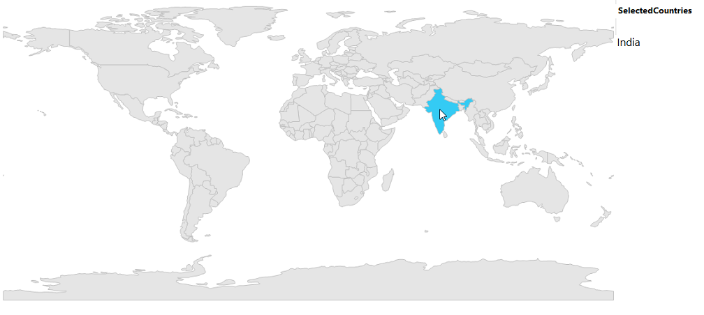
Single selection
Single selection allows only one map shape to be selected at a time. The user can select the shape by tapping the shape. Single selection is enabled by setting the EnableSelection property of ShapeFileLayer. If the EnableSelection property is set to true, the shapes can be selected. If it is set to false, the shapes cannot be selected. When any other shape or the map area is selected, the shape that has been already selected will be unselected.
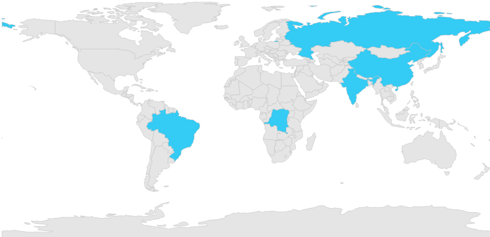
Multi selection
Multiple shapes in the map can be selected when the SelectionMode of ShapeFileLayer is set to multiple. Multiple selection can be done when selecting the shapes parallel by pressing Ctrl key. If the Ctrl key is released, single selection will be performed.
partial class Form1
{
    private Syncfusion.Windows.Forms.Maps.Maps mapsControl1;

    private void InitializeComponent()
    {
        this.mapsControl1 = new Syncfusion.Windows.Forms.Maps.Maps();
        this.mapsControl1.Name = "mapsControl1";
        this.mapsControl1.Size = new System.Drawing.Size(880, 585);
        this.Controls.Add(this.mapsControl1);
        this.ClientSize = new System.Drawing.Size(880, 585);
        this.Load += new System.EventHandler(this.Form1_Load);
    }
}
Partial Class Form1
Private mapsControl1 As Syncfusion.Windows.Forms.Maps.Maps
Private Sub InitializeComponent()
Me.mapsControl1 = New Syncfusion.Windows.Forms.Maps.Maps()
Me.mapsControl1.Name = "mapsControl1"
Me.mapsControl1.Size = New System.Drawing.Size(880, 585)
Me.Controls.Add(Me.mapsControl1)
Me.ClientSize = New System.Drawing.Size(880, 585)
AddHandler Me.Load, New System.EventHandler(AddressOf Me.Form1_Load)
End Sub
End Classpublic partial class Form1 : Form
{
private void Form1_Load(object sender, EventArgs e)
{
this.mapsControl1.Dock = DockStyle.Fill;
this.mapsControl1.Margin = new Padding(0, 0, 4, 0);
this.mapsControl1.MapBackgroundBrush = new SolidBrush(Color.White);
this.mapsControl1.MapItemsShape = Syncfusion.Windows.Forms.Maps.MapItemShapes.None;
ShapeFileLayer shapeLayer = new ShapeFileLayer();
shapeLayer.ShapeSetting.FillSetting.AutoFillColors = false;
shapeLayer.Uri = "world1.shp";
shapeLayer.ShapeIDPath = "Country";
shapeLayer.EnableSelection = true;
shapeLayer.SelectionMode = SelectionModes.Multiple;
shapeLayer.ShapeIDTableField = "NAME";
shapeLayer.ShowMapItem = false;
this.mapsControl1.Layers.Add(shapeLayer);
}
}Public Partial Class Form1
Inherits Form
Private Sub Form1_Load(sender As Object, e As EventArgs)
Me.mapsControl1.Dock = DockStyle.Fill
Me.mapsControl1.Margin = New Padding(0, 0, 4, 0)
Me.mapsControl1.MapBackgroundBrush = New SolidBrush(Color.White)
Me.mapsControl1.MapItemsShape = Syncfusion.Windows.Forms.Maps.MapItemShapes.None
Dim shapeLayer As New ShapeFileLayer()
shapeLayer.ShapeSetting.FillSetting.AutoFillColors = False
shapeLayer.Uri = "world1.shp"
shapeLayer.ShapeIDPath = "Country"
shapeLayer.EnableSelection = True
shapeLayer.SelectionMode = SelectionModes.Multiple
shapeLayer.ShapeIDTableField = "NAME"
shapeLayer.ShowMapItem = False
Me.mapsControl1.Layers.Add(shapeLayer)
End Sub
End Class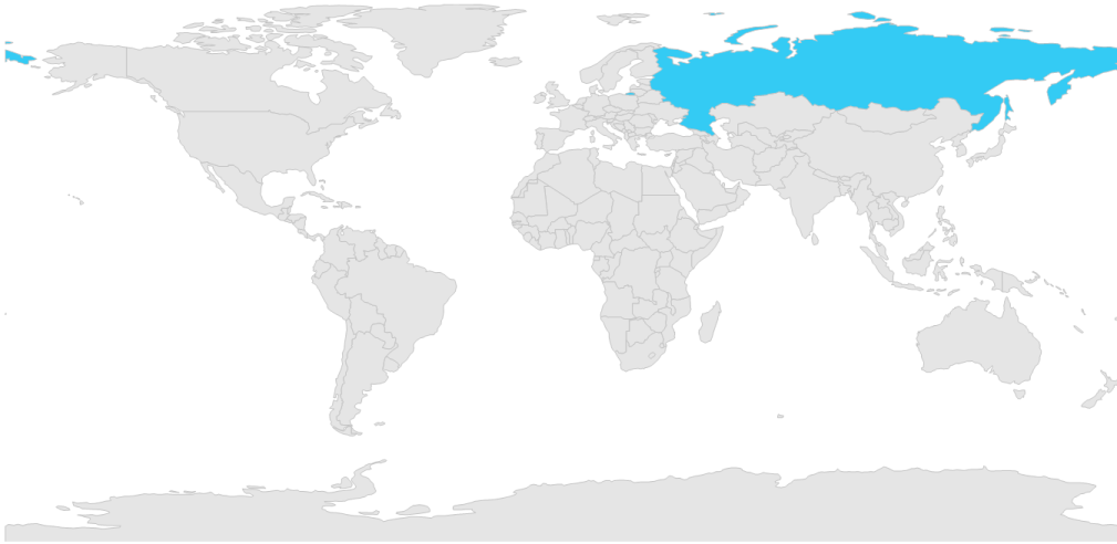
Multiple selection can be performed by selecting the map shape and holding the ctrl key over the map.
Zooming
Zooming can be done in maps in the following two ways:
- ZoomFactor
- ZoomLevel
Zoom using ZoomFactor
By changing the ZoomFactor value, maps can be zoomed. If the ZoomFactor value is increased, map will be ZoomIn based on the ZoomFactor value.
partial class Form1
{
    private Syncfusion.Windows.Forms.Maps.Maps mapsControl1;

    private void InitializeComponent()
    {
        this.mapsControl1 = new Syncfusion.Windows.Forms.Maps.Maps();
        this.mapsControl1.Name = "mapsControl1";
        this.mapsControl1.Size = new System.Drawing.Size(880, 585);
        this.Controls.Add(this.mapsControl1);
        this.ClientSize = new System.Drawing.Size(880, 585);
        this.Load += new System.EventHandler(this.Form1_Load);
    }
}
Partial Class Form1
Private mapsControl1 As Syncfusion.Windows.Forms.Maps.Maps
Private Sub InitializeComponent()
Me.mapsControl1 = New Syncfusion.Windows.Forms.Maps.Maps()
Me.mapsControl1.Name = "mapsControl1"
Me.mapsControl1.Size = New System.Drawing.Size(880, 585)
Me.Controls.Add(Me.mapsControl1)
Me.ClientSize = New System.Drawing.Size(880, 585)
AddHandler Me.Load, New System.EventHandler(AddressOf Me.Form1_Load)
End Sub
End Classpublic partial class Form1 : Form
{
public Form1()
{
InitializeComponent();
}
private void Form1_Load(object sender, EventArgs e)
{
this.mapsControl1.MapBackgroundBrush = new SolidBrush(Color.White);
this.mapsControl1.MapItemsShape = Syncfusion.Windows.Forms.Maps.MapItemShapes.None;
this.mapsControl1.ZoomFactor = 0.75f;
MapViewModel model = new MapViewModel();
ShapeFileLayer shapeLayer = new ShapeFileLayer();
shapeLayer.Uri = "world1.shp";
shapeLayer.ItemSource = model.Countries;
shapeLayer.ShapeIDPath = "NAME";
shapeLayer.ShapeIDTableField = "NAME";
this.mapsControl1.Layers.Add(shapeLayer);
}
}Public Partial Class Form1
Inherits Form
Public Sub New()
InitializeComponent()
End Sub
Private Sub Form1_Load(sender As Object, e As EventArgs)
Me.mapsControl1.MapBackgroundBrush = New SolidBrush(Color.White)
Me.mapsControl1.MapItemsShape = Syncfusion.Windows.Forms.Maps.MapItemShapes.None
Me.mapsControl1.ZoomFactor = 0.75F
Dim model As New MapViewModel()
Dim shapeLayer As New ShapeFileLayer()
shapeLayer.Uri = "world1.shp"
shapeLayer.ItemSource = model.Countries
shapeLayer.ShapeIDPath = "NAME"
shapeLayer.ShapeIDTableField = "NAME"
Me.mapsControl1.Layers.Add(shapeLayer)
End Sub
End Class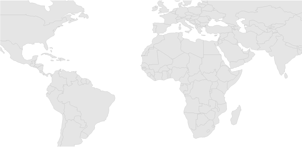
Zoom using ZoomLevel
When changing the ZoomLevel, the ZoomFactor value will also be changed. So, map will be zoomed based on the ZoomFactor value. The ZoomFactor value is determined when the ZoomLevel is changed. Initial ZoomFactor value is multiplied by the ZoomLevel value, then new value will be set to ZoomFactor.
partial class Form1
{
    private Syncfusion.Windows.Forms.Maps.Maps mapsControl1;

    private void InitializeComponent()
    {
        this.mapsControl1 = new Syncfusion.Windows.Forms.Maps.Maps();
        this.mapsControl1.Name = "mapsControl1";
        this.mapsControl1.Size = new System.Drawing.Size(880, 585);
        this.Controls.Add(this.mapsControl1);
        this.ClientSize = new System.Drawing.Size(880, 585);
        this.Load += new System.EventHandler(this.Form1_Load);
    }
}
Partial Class Form1
Private mapsControl1 As Syncfusion.Windows.Forms.Maps.Maps
Private Sub InitializeComponent()
Me.mapsControl1 = New Syncfusion.Windows.Forms.Maps.Maps()
Me.mapsControl1.Name = "mapsControl1"
Me.mapsControl1.Size = New System.Drawing.Size(880, 585)
Me.Controls.Add(Me.mapsControl1)
Me.ClientSize = New System.Drawing.Size(880, 585)
AddHandler Me.Load, New System.EventHandler(AddressOf Me.Form1_Load)
End Sub
End Classpublic partial class Form1 : Form
{
public Form1()
{
InitializeComponent();
}
private void Form1_Load(object sender, EventArgs e)
{
this.mapsControl1.MapBackgroundBrush = new SolidBrush(Color.White);
this.mapsControl1.MapItemsShape = Syncfusion.Windows.Forms.Maps.MapItemShapes.None;
this.mapsControl1.ZoomFactor = 0.75f;
this.mapsControl1.ZoomLevel = 4;
ShapeFileLayer shapeLayer = new ShapeFileLayer();
shapeLayer.Uri = "world1.shp";
this.mapsControl1.Layers.Add(shapeLayer);
}
}Public Partial Class Form1
Inherits Form
Public Sub New()
InitializeComponent()
End Sub
Private Sub Form1_Load(sender As Object, e As EventArgs)
Me.mapsControl1.MapBackgroundBrush = New SolidBrush(Color.White)
Me.mapsControl1.MapItemsShape = Syncfusion.Windows.Forms.Maps.MapItemShapes.None
Me.mapsControl1.ZoomFactor = 0.75F
Me.mapsControl1.ZoomLevel = 4
Dim shapeLayer As New ShapeFileLayer()
shapeLayer.Uri = "world1.shp"
Me.mapsControl1.Layers.Add(shapeLayer)
End Sub
End Class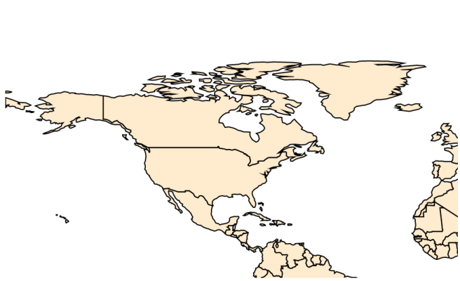
Events
The ShapeSelected event will be triggered when the map shapes are selected. A corresponding model data is passed as an argument.
Below code snippet displays the selected country name which is specified in the model data.
public partial class Form1 : Form
{
    private ListBox countryListBox;

    private void Form1_Load(object sender, EventArgs e)
    {
        // Create ListBox control
        countryListBox = new ListBox();
        this.Controls.Add(countryListBox);

        // Wire up ShapeSelected event
        this.mapsControl1.ShapeSelected += mapsControl1_ShapeSelected;
    }

    private void mapsControl1_ShapeSelected(object sender, ShapeSelectedEventArgs e)
    {
        countryListBox.Items.Clear();

        if (e.Data != null)
        {
            foreach (Countries shape in e.Data)
            {
                countryListBox.Items.Add(shape.Country);
            }
        }
    }
}
Public Partial Class Form1
Inherits Form
Private countryListBox As ListBox
Private Sub Form1_Load(sender As Object, e As EventArgs)
countryListBox = New ListBox()
Me.Controls.Add(countryListBox)
AddHandler Me.mapsControl1.ShapeSelected, AddressOf mapsControl1_ShapeSelected
End Sub
Private Sub mapsControl1_ShapeSelected(sender As Object, e As ShapeSelectedEventArgs)
countryListBox.Items.Clear()
If e.Data IsNot Nothing Then
For Each shape As Countries In e.Data
countryListBox.Items.Add(shape.Country)
Next
End If
End Sub
End Class