Getting Started with Blazor Maps in MAUI App
This section explains the step-by-step process of integrating the Blazor Maps component into your Blazor MAUI App using both Visual Studio, Visual Studio Code and the .NET CLI.
Create a new MAUI Blazor Hybrid App
Create a Blazor MAUI App using Visual Studio via Microsoft Templates. For detailed instructions, refer to the Blazor MAUI App Getting Started documentation.
Run the following command to create a new MAUI Blazor Hybrid App.
dotnet new maui-blazor -o MauiBlazorApp
cd MauiBlazorApp
Run the following command to create a new MAUI Blazor Hybrid App.
dotnet new maui-blazor -o MauiBlazorApp
cd MauiBlazorApp
Install required Blazor packages
Install the Syncfusion.Blazor.Maps NuGet package. All Syncfusion Blazor packages are available on nuget.org. See the NuGet packages topic for details.
- Go to Tools → NuGet Package Manager → Manage NuGet Packages for Solution.
- Search the required NuGet package (
Syncfusion.Blazor.Maps) and install it.
Alternatively, you can install the same package using the Package Manager Console with the following command.
Install-Package Syncfusion.Blazor.Maps -Version 35.1.37Open the terminal and run the following command.
dotnet add package Syncfusion.Blazor.Maps -v 35.1.37Open the command prompt and run the following command.
dotnet add package Syncfusion.Blazor.Maps -v 35.1.37Add import namespaces
After the package is installed, open the ~/Components/_Imports.razor file and import the Syncfusion.Blazor and Syncfusion.Blazor.Maps namespaces.
@using Syncfusion.Blazor
@using Syncfusion.Blazor.Maps
Register the Blazor service
Open the MauiProgram.cs file in Blazor MAUI App and register the Blazor service.
....
using Syncfusion.Blazor;
....

public static class MauiProgram
{
    public static MauiApp CreateMauiApp()
    {
        ....
        builder.Services.AddSyncfusionBlazor();
        ....
    }
}
Add script resource
The script can be accessed from NuGet through Static Web Assets. Include the script references in the ~wwwroot/index.html file.
<script src="_content/Syncfusion.Blazor.Core/scripts/syncfusion-blazor.min.js" type="text/javascript"></script>Add Blazor Maps component with GeoJSON data
Open a Razor file located in the ~/Components/Pages/*.razor (for example, Home.razor) and add the Blazor Maps component inside the razor file. Bind GeoJSON data to the Maps to render any geometric shape in SVG (Scalable Vector Graphics) for powerful data visualization of shapes. You can use the ShapeData property in MapsLayer to load the GeoJSON shape data into the Maps component.
@using Syncfusion.Blazor.Maps

@* SfMaps is the root container component for the maps *@
<SfMaps>
    @* MapsLayers contains one or more map layers to display on the map *@
    <MapsLayers>
        @* MapsLayer defines a map layer with shape data and configuration *@
        <MapsLayer ShapeData='new {dataOptions= "https://cdn.syncfusion.com/maps/map-data/world-map.json"}' TValue="string">
        </MapsLayer>
    </MapsLayers>
</SfMaps>
The “world-map.json” file contains the World map GeoJSON data.
Run the application on Windows
Press Ctrl+F5 (Windows) or ⌘+F5 (macOS) to launch the application. The Blazor Maps component will render in your default web browser.
Open the terminal and run the following command.
dotnet runOpen the command prompt and run the following command.
dotnet run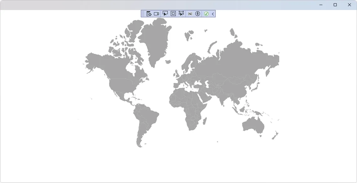
Run the application on Android
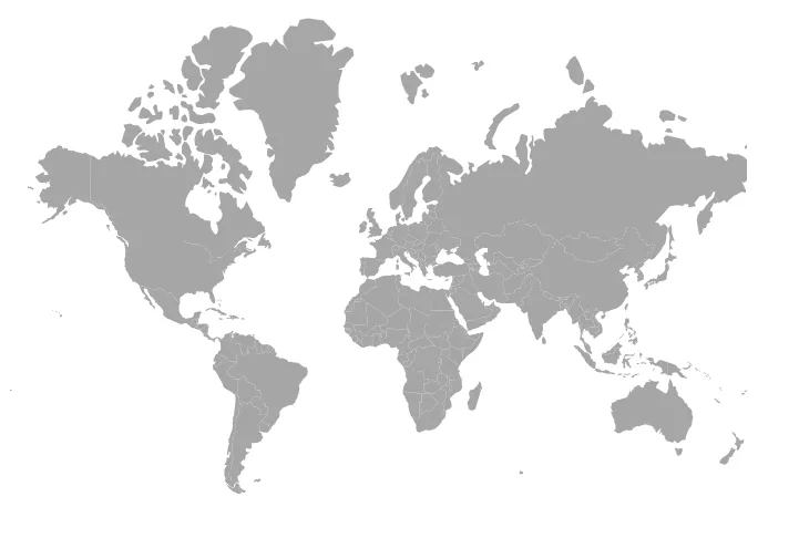
To run the Blazor Maps in a Blazor Android MAUI application using the Android emulator, follow these steps:
Refer here to install and launch Android emulator.
If you encounter any errors while using the Android Emulator, refer to the following link for troubleshooting guidanceTroubleshooting Android Emulator.
Bind data source
The DataSource property is used to represent statistical data in the Maps component. You can define a list of objects as a data source to the Maps component. This data source will be further used to color the map, display data labels, display tooltips, and more. Assign the below list SecurityCouncilDetails to the DataSource property in MapsLayer.
@code {
    public List<UNCouncilCountry> SecurityCouncilDetails = new List<UNCouncilCountry>{
         new UNCouncilCountry { Name= "China", Membership= "Permanent" },
         new UNCouncilCountry { Name= "France", Membership= "Permanent" },
         new UNCouncilCountry { Name= "Russia", Membership= "Permanent" },
         new UNCouncilCountry { Name= "Kazakhstan", Membership= "Non-Permanent" },
         new UNCouncilCountry { Name= "Poland", Membership= "Non-Permanent" },
         new UNCouncilCountry { Name= "Sweden", Membership= "Non-Permanent" },
         new UNCouncilCountry { Name= "United Kingdom", Membership= "Permanent" },
         new UNCouncilCountry { Name= "United States", Membership= "Permanent" },
         new UNCouncilCountry { Name= "Bolivia", Membership= "Non-Permanent" },
         new UNCouncilCountry { Name= "Eq. Guinea", Membership= "Non-Permanent" },
         new UNCouncilCountry { Name= "Ethiopia", Membership= "Non-Permanent" },
         new UNCouncilCountry { Name= "Côte d Ivoire", Membership= "Permanent" },
         new UNCouncilCountry { Name= "Kuwait", Membership= "Non-Permanent" },
         new UNCouncilCountry { Name= "Netherlands", Membership= "Non-Permanent" },
         new UNCouncilCountry { Name= "Peru", Membership= "Non-Permanent" }
    };

    public class UNCouncilCountry
    {
        public string Name { get; set; }
        public string Membership { get; set; }
    };
}
The United Nations Security Council data is referred from source.
You should also specify the field names in the shape data and data source to the ShapePropertyPath and ShapeDataPath properties, respectively. These are used to identify the appropriate shapes and match the specific data source values to them.
The following complete example shows a Maps component with the GeoJSON layer and data source binding:
@using Syncfusion.Blazor.Maps

<SfMaps>
    <MapsLayers>
        <MapsLayer ShapeData='new {dataOptions= "https://cdn.syncfusion.com/maps/map-data/world-map.json"}'
                   ShapePropertyPath='new string[] {"name"}'
                   DataSource="SecurityCouncilDetails"
                   ShapeDataPath="Name" TValue="UNCouncilCountry">
        </MapsLayer>
    </MapsLayers>
</SfMaps>

@code {
    public List<UNCouncilCountry> SecurityCouncilDetails = new List<UNCouncilCountry>{
         new UNCouncilCountry { Name= "China", Membership= "Permanent" },
         new UNCouncilCountry { Name= "France", Membership= "Permanent" },
         new UNCouncilCountry { Name= "Russia", Membership= "Permanent" },
         new UNCouncilCountry { Name= "Kazakhstan", Membership= "Non-Permanent" },
         new UNCouncilCountry { Name= "Poland", Membership= "Non-Permanent" },
         new UNCouncilCountry { Name= "Sweden", Membership= "Non-Permanent" },
         new UNCouncilCountry { Name= "United Kingdom", Membership= "Permanent" },
         new UNCouncilCountry { Name= "United States", Membership= "Permanent" },
         new UNCouncilCountry { Name= "Bolivia", Membership= "Non-Permanent" },
         new UNCouncilCountry { Name= "Eq. Guinea", Membership= "Non-Permanent" },
         new UNCouncilCountry { Name= "Ethiopia", Membership= "Non-Permanent" },
         new UNCouncilCountry { Name= "Côte d Ivoire", Membership= "Permanent" },
         new UNCouncilCountry { Name= "Kuwait", Membership= "Non-Permanent" },
         new UNCouncilCountry { Name= "Netherlands", Membership= "Non-Permanent" },
         new UNCouncilCountry { Name= "Peru", Membership= "Non-Permanent" }
    };

    public class UNCouncilCountry
    {
        public string Name { get; set; }
        public string Membership { get; set; }
    };
}
This example demonstrates the complete setup with:
- The ShapeData pointing to the GeoJSON world map
- The ShapePropertyPath set to
"name"to match shape names - The DataSource bound to
SecurityCouncilDetails - The ShapeDataPath set to
"Name"to match data source field
Please refer to the section for more information on data binding.