OpenStreetMap in ASP.NET Core Maps
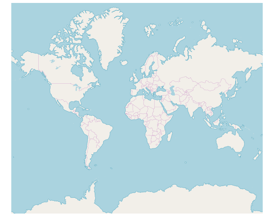
The OpenStreetMap (OSM) is the online Maps provider built by a community of developers; it is free to use under an open license. It allows to view geographical data in a collaborative way from anywhere on the earth. The OSM Maps provides small tile images based on our requests and combines those images into a single image to display the Maps area in the Maps component.
Adding OpenStreetMap
The OSM Maps can be rendered using the UrlTemplate property.
@using Syncfusion.EJ2;
   <ejs-maps id="maps">
        <e-maps-layers>
            <e-maps-layer urlTemplate="http://a.tile.openstreetmap.org/level/tileX/tileY.png"></e-maps-layer>
        </e-maps-layers>
    </ejs-maps>
using System;
using System.Collections.Generic;
using System.Diagnostics;
using System.Linq;
using System.Threading.Tasks;
using Microsoft.AspNetCore.Mvc;
using EJ2_Core_Application.Models;
using Newtonsoft.Json;
namespace EJ2_Core_Application.Controllers
{
public class HomeController : Controller
{
public IActionResult Index()
{
return View();
}
}
}
Changing the tile server of the OpenStreetMap
The OSM tile server can be changed by setting the tile URL in the UrlTemplate property. For more details about the OSM tile server, refer here.
Enabling zooming and panning
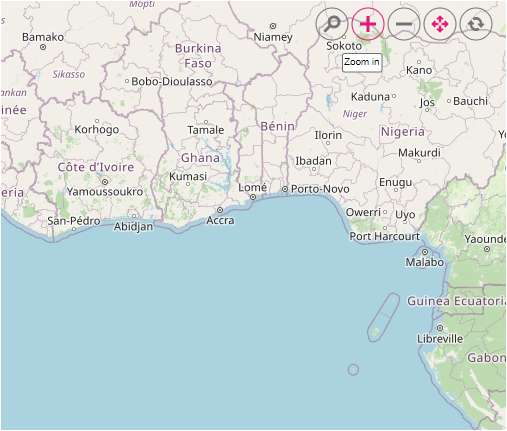
The OSM Maps layer can be zoomed and panned. Zooming helps to get a closer look at a particular area on a Maps for in-depth analysis. Panning helps to move a Maps around to focus the targeted area.
@using Syncfusion.EJ2;
   <ejs-maps id="maps">
        <e-maps-zoomSettings Enable="true"></e-maps-zoomSettings>
        <e-maps-layers>
            <e-maps-layer urlTemplate="http://a.tile.openstreetmap.org/level/tileX/tileY.png"></e-maps-layer>
        </e-maps-layers>
    </ejs-maps>
using System;
using System.Collections.Generic;
using System.Diagnostics;
using System.Linq;
using System.Threading.Tasks;
using Microsoft.AspNetCore.Mvc;
using EJ2_Core_Application.Models;
using Newtonsoft.Json;
namespace EJ2_Core_Application.Controllers
{
public class HomeController : Controller
{
public IActionResult Index()
{
return View();
}
}
}
Adding markers and navigation line
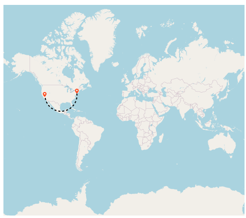
Markers can be added to the layers of OSM Maps by setting the corresponding location’s coordinates of latitude and longitude using MarkerSettings. Navigation lines can be added on top of an OSM Maps layer for highlighting a path among various places by setting the corresponding location’s coordinates of latitude and longitude in the NavigationLineSettings.
@{
    var marker = new List<MapsMarker>
    {
        new MapsMarker{Visible=true, DataSource=ViewBag.markerData}
    };

    }

@using Syncfusion.EJ2.Maps;
@using Syncfusion.EJ2;
<div id="control-section">
    <ejs-maps id="maps" load="window.onMapLoad">
        <e-maps-layers>
            <e-maps-layer urlTemplate="http://a.tile.openstreetmap.org/level/tileX/tileY.png" markerSettings="marker"></e-maps-layer>
        </e-maps-layers>
    </ejs-maps>
</div>

<script>
    function onMapLoad(args) {
        args.maps.layers[0].navigationLineSettings = [
            {
                visible: true,
                latitude: [40.7128, 36.7783],
                longitude: [-74.0060, -119.4179],
                color: 'black',
                angle: 90,
                width: 2,
                dashArray: '4'
            }
        ];
    }
</script>
using System;
using System.Collections.Generic;
using System.Diagnostics;
using System.Linq;
using System.Threading.Tasks;
using Microsoft.AspNetCore.Mvc;
using EJ2_Core_Application.Models;
using Newtonsoft.Json;
namespace EJ2_Core_Application.Controllers
{
public class HomeController : Controller
{
public IActionResult Index()
{
List<MarkerData> data = new List<MarkerData>
{
new MarkerData {latitude= 37.0000, longitude= -120.0000, city= "California" },
new MarkerData {latitude= 40.7127, longitude= -74.0059, city= "New York" },
new MarkerData {latitude= 42.0000, longitude= -93.0000, city= "Iowa" }
};
ViewBag.markerData = data;
return View();
}
public class MarkerData
{
public double latitude { get; set; }
public double longitude { get; set; }
public string city { get; set; }
}
}
}
Adding sublayer
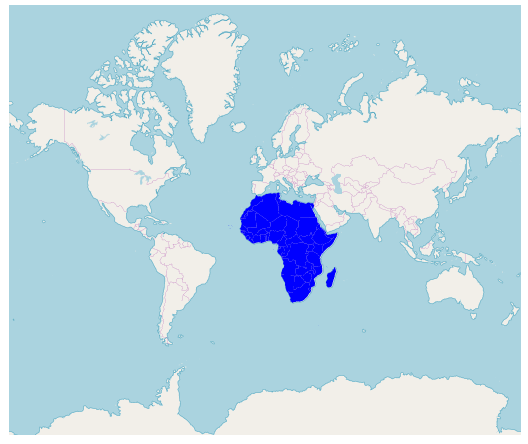
Any GeoJSON shape can be rendered as a sublayer on top of the OSM Maps layer for highlighting a particular continent or country in OSM Maps by adding another layer and specifying the Type property of Maps layer to SubLayer.
@{
}
@using Syncfusion.EJ2;
<ejs-maps id="maps">
        <e-maps-layers>
            <e-maps-layer urlTemplate="http://a.tile.openstreetmap.org/level/tileX/tileY.png"></e-maps-layer>
            <e-maps-layer type="SubLayer" shapeData="ViewBag.africaMap">
               <e-layersettings-shapesettings fill="blue"></e-layersettings-shapesettings>
            </e-maps-layer>
        </e-maps-layers>
</ejs-maps>
using System;
using System.Collections.Generic;
using System.Diagnostics;
using System.Linq;
using System.Threading.Tasks;
using Microsoft.AspNetCore.Mvc;
using EJ2_Core_Application.Models;
using Newtonsoft.Json;
namespace EJ2_Core_Application.Controllers
{
public class HomeController : Controller
{
public IActionResult Index()
{
ViewBag.africeMap = GetAfricaMap();
ViewBag.africaMapShape = GetAfricaShape();
return View();
}
public object GetAfricaMap()
{
string allText = System.IO.File.ReadAllText("./wwwroot/scripts/MapsData/Africa.json");
return JsonConvert.DeserializeObject(allText);
}
public object GetAfricaShape()
{
string allText = System.IO.File.ReadAllText(Server.MapPath("~/App_Data/Africa.json"));
return JsonConvert.DeserializeObject(allText, typeof(object));
}
}
}
Enabling legend
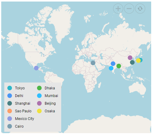
The legend can be added to the tile Maps by setting the Visible property of LegendSettings to true.
@using Syncfusion.EJ2;

@{
    var TextStyle = new MapsFont { Size = "16px", FontFamily = "inherit" };
    var Markers = new List<Syncfusion.EJ2.Maps.MapsMarker>
    {
        new Syncfusion.EJ2.Maps.MapsMarker
        {
            Visible = true, LegendText = "name", Shape = Syncfusion.EJ2.Maps.MarkerType.Circle, Width = 15, Height = 15, ColorValuePath = "color",
            TooltipSettings = new MapsTooltipSettings { Visible = true, ValuePath="name", Format= "City Name: ${name} <br> Population: ${population} million" },
            DataSource = new[]
            {
                new { name="Tokyo", latitude=35.6805245924747, longitude=139.76770396213337, population=37435191, color="#2EB6C8"},
                new { name="Delhi", latitude=28.644800, longitude=77.216721, population=29399141, color="#4A97F4"},
                new { name="Shanghai", latitude=31.224361, longitude=121.469170, population=26317104, color="#498082"},
                new { name="Sao Paulo", latitude=-23.550424484747914, longitude=-46.646471636488315, population=21846507, color="#FB9E67"},
                new { name="Mexico City", latitude=19.427402397418774, longitude=-99.131123716666, population=21671908, color="#8F9DE3"},
                new { name="Cairo ", latitude=30.033333, longitude=31.233334, population=20484965, color="#7B9FB0"},
                new { name="Dhaka", latitude=23.777176, longitude=90.399452, population=20283552, color="#4DB647"},
                new { name="Mumbai", latitude=19.08492049646163, longitude=72.87449446319248, population=20185064, color="#30BEFF"},
                new { name="Beijing", latitude=39.90395970055848, longitude=116.38831272088059, population=20035455, color="#Ac72AD"},
                new { name="Osaka", latitude=34.69024500601642, longitude=135.50746225677142, population=19222665, color="#EFE23E"}
            }
        }
    };
}

<ejs-maps id="maps" load="onLoad"  width="100%" format="n" useGroupingSeparator="true">
    <e-maps-legendsettings visible="true" height="170px" type="@Syncfusion.EJ2.Maps.LegendType.Markers" position="@Syncfusion.EJ2.Maps.LegendPosition.Float" background="#E6E6E6">
         <e-legendsettings-textstyle color="#000000" fontFamily="inherit"  />
     </e-maps-legendsettings>
     <e-maps-layers>
         <e-maps-layer urlTemplate="https://tile.openstreetmap.org/level/tileX/tileY.png" markerSettings="@Markers"></e-maps-layer>
     </e-maps-layers>
</ejs-maps>

<script>
    function onLoad(args) {
        args.maps.legendSettings.location.x = 10;
        args.maps.legendSettings.location.y = 262;
    }
</script>
using System;
using System.Collections.Generic;
using System.Diagnostics;
using System.Linq;
using System.Threading.Tasks;
using Microsoft.AspNetCore.Mvc;
using EJ2_Core_Application.Models;
using Newtonsoft.Json;
namespace EJ2_Core_Application.Controllers
{
public class HomeController : Controller
{
public IActionResult Index()
{
return View();
}
}
}