Bing Maps in ASP.NET Core Maps Component
Bing Maps is a online Maps provider, owned by Microsoft. As like OSM, it provide Maps tile images based on our requests and combines those images into a single one to display Maps area.
Adding Bing Maps
The Bing Maps can be rendered using the UrlTemplateproperty, which is based on the URL generated by the GetBingUrlTemplate method in the Maps. The format of the required URL of Bing Maps varies from other online map providers. As a result, a built-in GetBingUrlTemplate method has been included that returns the URL in a generic format. In the meantime, a subscription key is required for Bing Maps. The Bing Maps key can be obtained from here, then append it to the Bing Maps URL before passing it to the GetBingUrlTemplate method. The URL returned by this method must be passed to the UrlTemplate property.
@using Syncfusion.EJ2;
    <ejs-maps id="maps" load="onLoad">
        <e-maps-layers>
            <e-maps-layer></e-maps-layer>
        </e-maps-layers>
    </ejs-maps>

    <script>

      function onLoad(args) {
          args.maps.getBingUrlTemplate("https://dev.virtualearth.net/REST/V1/Imagery/Metadata/CanvasLight?output=json&uriScheme=https&key=?").then(function(url) {
              args.maps.layers[0].urlTemplate= url;
          });
      }

  </script>
using System;
using System.Collections.Generic;
using System.Diagnostics;
using System.Linq;
using System.Threading.Tasks;
using Microsoft.AspNetCore.Mvc;
using EJ2_Core_Application.Models;
using Newtonsoft.Json;
namespace EJ2_Core_Application.Controllers
{
public class HomeController : Controller
{
public IActionResult Index()
{
return View();
}
}
}
Types of Bing Maps
Bing Maps provides different types of Maps and it is supported in the Maps component.
- Aerial - Displays satellite images to highlight roads and major landmarks for easy identification.
- AerialWithLabel - Displays aerial Maps with labels for the continent, country, ocean, etc.
- Road - Displays the default Maps view of roads, buildings, and geography.
- CanvasDark - Displays dark version of the road Maps.
- CanvasLight - Displays light version of the road Maps.
- CanvasGray - Displays grayscale version of the road Maps.
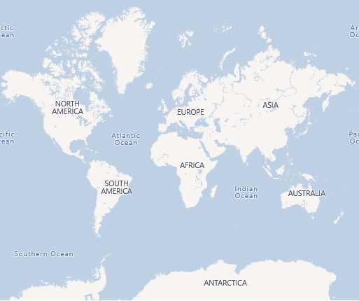
To render the light version of the road Maps, set the CanvasLight value is passed via the URL into the GetBingUrlTemplate method demonstrated in the following code sample.
@using Syncfusion.EJ2;
    <ejs-maps id="maps" load="onLoad">
        <e-maps-layers>
            <e-maps-layer></e-maps-layer>
        </e-maps-layers>
    </ejs-maps>

    <script>

      function onLoad(args) {
          args.maps.getBingUrlTemplate("https://dev.virtualearth.net/REST/V1/Imagery/Metadata/CanvasLight?output=json&uriScheme=https&key=?").then(function(url) {
              args.maps.layers[0].urlTemplate= url;
          });
      }

  </script>
using System;
using System.Collections.Generic;
using System.Diagnostics;
using System.Linq;
using System.Threading.Tasks;
using Microsoft.AspNetCore.Mvc;
using EJ2_Core_Application.Models;
using Newtonsoft.Json;
namespace EJ2_Core_Application.Controllers
{
public class HomeController : Controller
{
public IActionResult Index()
{
return View();
}
}
}
Enabling zooming and panning
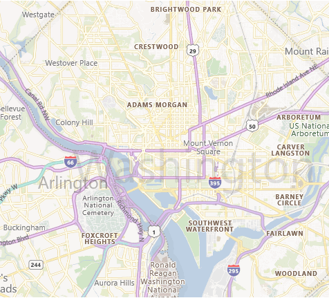
Bing Maps layer can be zoomed and panned. Zooming helps to get a closer look at a particular area on a Maps for in-depth analysis. Panning helps to move a Maps around to focus the targeted area.
@using Syncfusion.EJ2;
   <ejs-maps id="maps" load="onMapLoad">
        <e-maps-zoomSettings Enable="true"></e-maps-zoomSettings>
        <e-maps-layers>
            <e-maps-layer></e-maps-layer>
        </e-maps-layers>
    </ejs-maps>

    <script>
        function onMapLoad(args) {
            args.maps.getBingUrlTemplate("https://dev.virtualearth.net/REST/V1/Imagery/Metadata/CanvasLight?output=json&uriScheme=https&key=?").then(function(url) {
                  args.maps.layers[0].urlTemplate= url;
            });
        }
    </script>
using System;
using System.Collections.Generic;
using System.Diagnostics;
using System.Linq;
using System.Threading.Tasks;
using Microsoft.AspNetCore.Mvc;
using EJ2_Core_Application.Models;
using Newtonsoft.Json;
namespace EJ2_Core_Application.Controllers
{
public class HomeController : Controller
{
public IActionResult Index()
{
return View();
}
}
}
Adding markers and navigation line
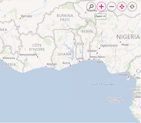
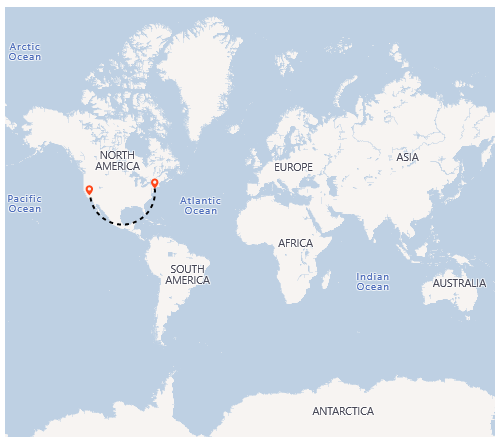
Markers can be added to the layers of Bing Maps by setting the corresponding location’s coordinates of latitude and longitude using MarkerSettings. Navigation lines can be added on top of an Bing Maps layer for highlighting a path among various places by setting the corresponding location’s coordinates of latitude and longitude in the NavigationLineSettings.
@{
    var marker = new List<MapsMarker>
    {
        new MapsMarker{Visible=true, DataSource=ViewBag.markerData}
    };

    }

@using Syncfusion.EJ2.Maps;
@using Syncfusion.EJ2;
<div id="control-section">
    <ejs-maps id="maps" load="window.onMapLoad">
        <e-maps-layers>
            <e-maps-layer markerSettings="marker"></e-maps-layer>
        </e-maps-layers>
    </ejs-maps>
</div>

<script>
    function onMapLoad(args) {
        args.maps.getBingUrlTemplate("https://dev.virtualearth.net/REST/V1/Imagery/Metadata/CanvasLight?output=json&uriScheme=https&key=?").then(function(url) {
              args.maps.layers[0].urlTemplate= url;
        });
        args.maps.layers[0].navigationLineSettings = [
            {
                visible: true,
                latitude: [40.7128, 36.7783],
                longitude: [-74.0060, -119.4179],
                color: 'black',
                angle: 90,
                width: 2,
                dashArray: '4'
            }
        ];
    }
</script>
using System;
using System.Collections.Generic;
using System.Diagnostics;
using System.Linq;
using System.Threading.Tasks;
using Microsoft.AspNetCore.Mvc;
using EJ2_Core_Application.Models;
using Newtonsoft.Json;
namespace EJ2_Core_Application.Controllers
{
public class HomeController : Controller
{
public IActionResult Index()
{
List<MarkerData> data = new List<MarkerData>
{
new MarkerData {latitude= 37.0000, longitude= -120.0000, city= "California" },
new MarkerData {latitude= 40.7127, longitude= -74.0059, city= "New York" },
new MarkerData {latitude= 42.0000, longitude= -93.0000, city= "Iowa" }
};
ViewBag.markerData = data;
return View();
}
public class MarkerData
{
public double latitude { get; set; }
public double longitude { get; set; }
public string city { get; set; }
}
}
}
Adding sublayer
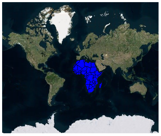
Any GeoJSON shape can be rendered as a sublayer on top of the Bing Maps layer for highlighting a particular continent or country in Bing Maps by adding another layer and specifying the Type property of Maps layer to SubLayer.
<ejs-maps id="maps" load="onLoad">
    <e-maps-layers>
        <e-maps-layer>
        </e-maps-layer>
        <e-maps-layer type="SubLayer" shapeData="ViewBag.africa">
            <e-layersettings-shapesettings fill="blue"></e-layersettings-shapesettings>
        </e-maps-layer>
    </e-maps-layers>
</ejs-maps>

<script>

    function onLoad(args) {
          args.maps.getBingUrlTemplate("https://dev.virtualearth.net/REST/V1/Imagery/Metadata/Aerial?output=json&uriScheme=https&key=?").then(function(url) {
              args.maps.layers[0].urlTemplate= url;
          });
    }

</script>
using Newtonsoft.Json;
namespace EJ2_Core_Application.Controllers
{
public class HomeController : Controller
{
public IActionResult Index()
{
ViewBag.africa = GetAfricaMap();
ViewBag.africaShape = GetAfricaShape();
return View();
}
public object GetAfricaShape()
{
string allText = System.IO.File.ReadAllText(Server.MapPath("~/App_Data/Africa.json"));
return JsonConvert.DeserializeObject(allText, typeof(object));
}
public object GetAfricaMap()
{
string text = System.IO.File.ReadAllText("./wwwroot/scripts/MapsData/Africa.json");
return JsonConvert.DeserializeObject(text);
}
}
}
Enabling legend
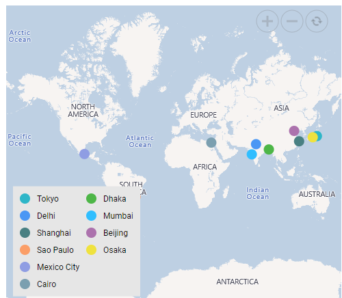
The legend can be added to the tile Maps by setting the Visible property of LegendSettings to true.
@using Syncfusion.EJ2;

  @{
    var TextStyle = new MapsFont { Size = "16px", FontFamily = "inherit" };
    var Markers = new List<Syncfusion.EJ2.Maps.MapsMarker>
    {
        new Syncfusion.EJ2.Maps.MapsMarker
        {
            Visible = true, LegendText = "name", Shape = Syncfusion.EJ2.Maps.MarkerType.Circle, Width = 15, Height = 15, ColorValuePath = "color",
            TooltipSettings = new MapsTooltipSettings { Visible = true, ValuePath="name", Format= "City Name: ${name} <br> Population: ${population} million" },
            DataSource = new[]
            {
                new { name="Tokyo", latitude=35.6805245924747, longitude=139.76770396213337, population=37435191, color="#2EB6C8"},
                new { name="Delhi", latitude=28.644800, longitude=77.216721, population=29399141, color="#4A97F4"},
                new { name="Shanghai", latitude=31.224361, longitude=121.469170, population=26317104, color="#498082"},
                new { name="Sao Paulo", latitude=-23.550424484747914, longitude=-46.646471636488315, population=21846507, color="#FB9E67"},
                new { name="Mexico City", latitude=19.427402397418774, longitude=-99.131123716666, population=21671908, color="#8F9DE3"},
                new { name="Cairo ", latitude=30.033333, longitude=31.233334, population=20484965, color="#7B9FB0"},
                new { name="Dhaka", latitude=23.777176, longitude=90.399452, population=20283552, color="#4DB647"},
                new { name="Mumbai", latitude=19.08492049646163, longitude=72.87449446319248, population=20185064, color="#30BEFF"},
                new { name="Beijing", latitude=39.90395970055848, longitude=116.38831272088059, population=20035455, color="#Ac72AD"},
                new { name="Osaka", latitude=34.69024500601642, longitude=135.50746225677142, population=19222665, color="#EFE23E"}
            }
        }
    };
}

@using Syncfusion.EJ2

<div class="control-section">
    <ejs-maps id="maps" load="onLoad"  width="100%" format="n" useGroupingSeparator="true">
       <e-maps-legendsettings visible="true" height="170px" type="@Syncfusion.EJ2.Maps.LegendType.Markers" position="@Syncfusion.EJ2.Maps.LegendPosition.Float" background="#E6E6E6">
            <e-legendsettings-textstyle color="#000000" fontFamily="inherit"  />
        </e-maps-legendsettings>
        <e-maps-layers>
            <e-maps-layer markerSettings="@Markers"></e-maps-layer>
        </e-maps-layers>
    </ejs-maps>
</div>


<script>

function onLoad(args) {
    args.maps.getBingUrlTemplate("https://dev.virtualearth.net/REST/V1/Imagery/Metadata/CanvasLight?output=json&uriScheme=https&key=?").then(function(url) {
        args.maps.layers[0].urlTemplate= url;
    });
    args.maps.legendSettings.location.x = 10;
    args.maps.legendSettings.location.y = 262;
}

</script>
using System;
using System.Collections.Generic;
using System.Diagnostics;
using System.Linq;
using System.Threading.Tasks;
using Microsoft.AspNetCore.Mvc;
using EJ2_Core_Application.Models;
using Newtonsoft.Json;
namespace EJ2_Core_Application.Controllers
{
public class HomeController : Controller
{
public IActionResult Index()
{
return View();
}
}
}